Wasser und Umwelt - Groundwater contour maps/plans
Groundwater contour maps/plans illustrate the conditions of groundwater flow in hydraulically-connected aquifers.
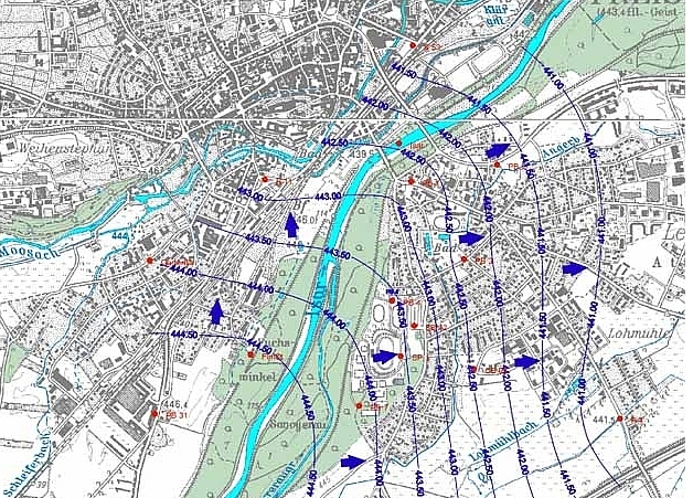
The projected map layers (scales ranging from 1:10,000 to 1:20,000) connect lines of equal piezometric heights of at least three groundwater monitoring wells based on meters above sea level. The groundwater flow direction is indicated by the groundwater gradient and thus the distance between two groundwater contours, and measured along a vertical line, which is projected on the contour line.
Measuring groundwater levels is required particularly for the observation of groundwater quantity, the determination of the long-term trend analysis of groundwater levels and the creation of basic data and reference values, e.g. for the assessment of the influence of storm flow events, construction planning, or for determining the depth of the wells.